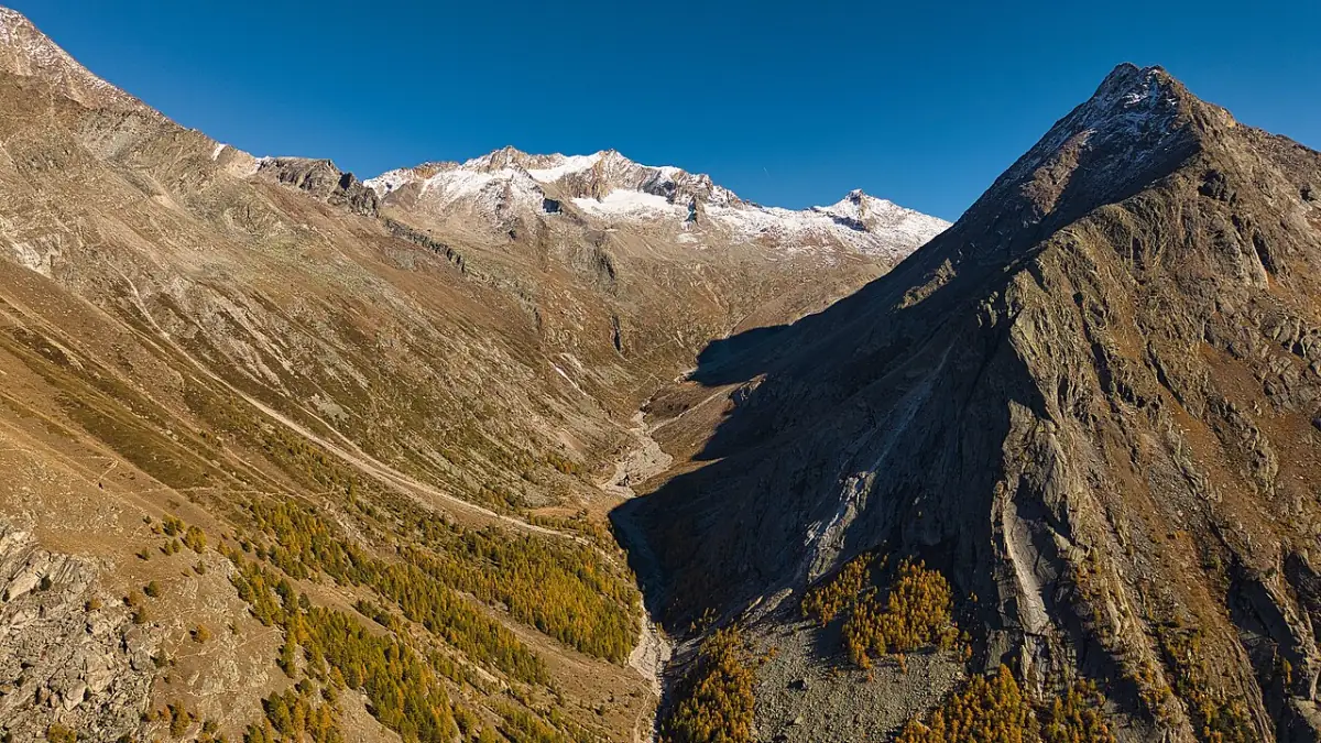
Hiking around Saas-Almagell
Match Saas-Almagell hikes to exposure and fitness first: Mattmark’s reservoir circuit is a gentler high outing when open; Furggstalden approaches suit lift-assisted days; the Adventure Trail is a short but difficult T4 route with suspension bridges. Always confirm trail and lift status for your date.
The Almagellertal above Saas-Almagell — context for high walks toward Almagelleralp.
This hub compares route types. Individual trail pages own distances, escape options and detailed caveats.
Route chooser
| Walk / area | Effort / exposure (planning) | Guide |
|---|---|---|
| Mattmark reservoir circuit | Easier shoreline outing when open; west shore accessibility noted by Valais Tourism | Mattmark (place); dedicated lake-walk page planned |
| Furggstalden / Heidbodmen | Lift-assisted; hamlet and viewpoint days | Furggstalden, Heidbodme |
| Adventure Trail | Short, T4 / difficult, bridges & secured rock | Adventure Trail |
| Almagelleralp approaches | Multiple options; verify grading per start point | Almagelleralp |
| Suonen Trail toward Saas-Grund | Named in official village copy — needs mapped route page before detailed advice | Coming as a dedicated draft when evidence is complete |
Rules of thumb
- Tourism marketing names are not difficulty grades.
- Summer path ≠ winter hiking route.
- Kids and dogs: read the Adventure Trail page before assuming family suitability.
- Carry a current map (SwissTopo sheets are commonly recommended on Valais route pages).
Live checks: open facilities. Season context: Summer. Family framing: Families.
Mattmark in more detail for hikers
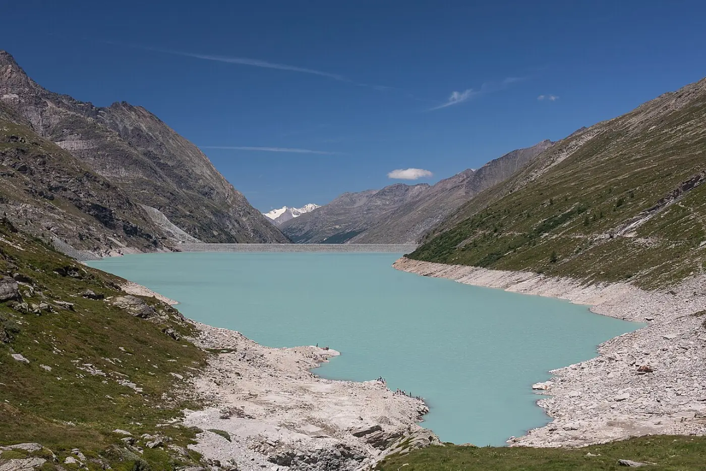
Mattmark is the high reservoir and earth-dam context at the valley head. Valais Tourism describes an approximately 8 km lakeside circuit near 2h15 with modest height gain and notes west-shore wheelchair/stroller accessibility on that specific shore — not uniform difficulty for the entire loop or for dam approaches. Saastal Tourism publishes seasonal PostBus windows to Mattmark on official dam summer pages (reconfirm annually). Drivers verify parking tariffs on the same sources.
Separate a crest viewpoint stop from a full circuit when planning with mixed fitness. History context: the 1965 Allalin glacier strike on the dam construction site is acknowledged on official pages — treat memorial areas respectfully.
Furggstalden and Heidbodmen as hike staging
Not every “hike day” needs T4 exposure. Furggstalden and Heidbodme provide lift access to hamlet wandering, panorama lunches, and verified short walks if you have mapped them. Official copy cites ~5 minutes to Furggstalden and ~12 more minutes to Heidbodmen when both segments run.
Adventure Trail recap for the hub
The Adventure Trail remains the exposure outlier: ~2.8 km, ~1.5 h, ~386 m ascent, T4, two suspension bridges (Valais cites ~60 m and ~45 m lengths), dogs not suitable, children ~6–7 minimum with adults per Valais guidance.
Almagelleralp and Kreuzboden connections
Almagelleralp approaches include continuations toward Kreuzboden / Saas-Grund context that need per-route verification. Official Saas-Almagell copy mentions Suonen Trail toward Saas-Grund as a named valley connection — publish turn-by-turn advice only when a dedicated mapped page exists.
Family and dog notes
Family framing: Families. Dogs: do not assume valley-wide dog access because one trail bans them; verify each route listing.
Sample week mix (planning sketch)
Day A Mattmark circuit or partial. Day B Furggstalden/Heidbodmen lift day. Day C Adventure Trail only if suitable. Day D Saas-Grund/Hohsaas hop via day trip. Buffer day for weather. Assumes operations and fitness match.
Common mistakes
Marketing “4000er” scenery photos do not imply T1 paths. Reusing summer apps in winter. Skipping last-bus checks at Mattmark. Treating Saas-Fee glacier lifts as Almagell local walks.
Official checks before every walk day
Lift-assisted hikes still depend on official opening information for Saas-Almagell. Tourism marketing names are not difficulty grades. Summer footpaths are not winter hiking routes. Carry a current map; SwissTopo sheets appear frequently on Valais route pages as the responsible planning baseline.
SaastalCard reminder for walkers
Partner overnight guests may ride many valley cable cars from the first night under published summer/autumn terms, with Metro Alpin excluded and arrival/departure PostBus legs excluded. Walking itself is often free, but lifts to trailheads are not automatically irrelevant to your budget. Read SaastalCard before you plan three consecutive lift days.
Weather and turnaround culture
MeteoSwiss forecasts for Saas-Almagell are the appropriate official weather entry for valley planning; microclimate at Mattmark, Furggstalden, or bridge terrain can differ. Afternoon thunderstorm risk is a routine reason to start early and accept turnaround without “summit fever.”
How Saas-Fee fits (label travel honestly)
Glacier experiences, Metro Alpin, and dense resort walking are Saas-Fee products for most visitors sleeping in Almagell. Day-trip framing belongs on Visiting Saas-Fee rather than implying those lifts are village-side doors.
Editorial limits
This site paraphrases Saastal Tourism and Valais route references checked 2026-10-20. No live trail status, no invented timings without sourced routes, no firsthand visit claims.
Expanded route-type notes
Think in route types, not destination slogans. A reservoir shore walk, a lift-to-hamlet wander, a T4 bridge traverse, and a high alp approach toward Almagelleralp share marketing photos of “4000er” scenery while demanding different footwear, weather windows, and group vetting. If two people on your trip disagree about heights, resolve that before you buy tickets — not at the first cable.
Use this hub to pick one primary type per day, then open the specialist page for that type. Mixing Adventure Trail exposure with a full Mattmark circuit on the same calendar day is a common overcommitment; keep them on separate days unless your group is unusually strong and weather is stable.
Destination walk clusters (expanded)
Valley-head cluster: Mattmark for dam and reservoir days — road or seasonal PostBus, not the Furggstalden chairlift.
Chairlift hamlet cluster: Furggstalden and Heidbodme for lift-assisted wandering and panorama lunches when segments operate.
Exposure cluster: Adventure Trail only after T4 and bridge suitability are accepted.
High-alp cluster: Almagelleralp for approaches from the village, Adventure Trail finishes, or Höhenweg context from Kreuzboden — each with its own grading and season checks.
Mid-valley hop: Saas-Grund / Kreuzboden days belong on Saas-Grund day trip, not as a silent rename of an Almagell walk.
Confirm cluster operations on official open facilities for Saas-Almagell and on Valais or Saastal route pages for the specific trail name you intend to follow.
How to read Swiss hiking grades on this site
Marketing copy often softens language (“adventure,” “experience,” “family favourite”). Swiss alpine grades do not. T1–T2 territory is where many first-time visitors should start; T3 already implies sure-footedness; T4 means difficult mountain path with exposure and possible use of hands. The Adventure Trail is published as T4 / difficult — treat that as a hard filter, not a challenge badge for children by default. Until a dedicated mapped page exists for Suonen or other named connections, do not invent grades from brochure adjacency.
Turnaround points and exit culture
Good hiking days in this valley usually include a named turnaround: Mattmark crest without the full loop; Furggstalden without the Adventure Trail; Almagelleralp without continuing toward Kreuzboden or Zwischbergen Pass. Publish the exit plan before you leave the village. Afternoon storms, slow photography, or a tired companion should trigger the exit you already agreed — not a negotiation on a narrow ledge.
Packing baseline for Saas-Almagell walks
Sturdy footwear with grip; layers; rain shell; sun protection; water and snacks beyond café assumptions; charged phone plus offline map or paper SwissTopo; small first-aid and blister care. Add gloves if you may touch cables or cold rock. Winter walkers need designated winter-route awareness and traction appropriate to conditions — summer mesh shoes are not a winter plan. This list is planning aid, not a certification of any route.
Winter: local snow without confusing resorts
Official winter messaging for Saas-Almagell and Furggstalden/Heidbodmen describes a compact, family-oriented ski area above the village, sledging, snow play (including Kian’s Adventureland references), winter hiking and snowshoeing leads. Published winter timetable pages list seasonal date windows and daily hours for the Furggstalden and Heidbodme lifts — treat those as planning anchors, not snow guarantees.
Practical distinctions:
- Local skiing at Furggstalden–Heidbodme is not the same product as the larger Saas-Fee network. Ticket rules differ.
- Tobogganing may have separate pedestrian/sledge ticket products from skier day passes.
- Winter walking should use designated winter routes — do not reuse summer path advice.
- Day skiing in Saas-Fee is a separate plan with bus timing and pass validity checks.
Deep dives: Skiing and Winter.
Sample sequences (assumptions stated)
These are planning sketches, not guaranteed itineraries. They assume lifts/buses operate and weather cooperates.
Two full days (first visit, summer)
Day 1 — Mattmark. Morning PostBus or drive to the dam; short crest stop or partial shore walk; return before last transport. Evening in the village.
Day 2 — Furggstalden / Heidbodmen. Chairlift day with lunch if open; optional short signed walk; skip Adventure Trail unless the group is clearly ready.
Three to four days (mixed interests)
Add a Saas-Fee day trip for the car-free resort atmosphere or larger lift system, keep one recovery / playground / low walk day, and optionally attempt the Adventure Trail only if conditions and fitness match. Winter versions swap Mattmark for local snow days and use Fee as the big-ski option when desired.
Itinerary pages with tighter hour-by-hour sequencing will publish separately once dated transport samples are locked.
Day trips beyond the village (keep the labels honest)
| Destination | Why go from Almagell | Page |
|---|---|---|
| Saas-Fee | Resort centre; larger ski / summer lift products | Day trip |
| Saas-Grund | Hohsaas / Kreuzboden focus | Day trip |
| Mattmark | Same valley head — outing, not a distant “excursion” | Mattmark |
| Zermatt | Long regional commitment via Visp corridor | Zermatt draft — verify dated door-to-door times before relying on it |
Hub overview: Day trips.
Bookable experiences and affiliate honesty
Third-party tour catalogues for this region often list Saas-Fee or other departure towns. A search result labelled for the valley is not proof the meeting point is in Saas-Almagell. This site only surfaces verified products with clear departure labels. Until inventory is confirmed, plan independently with official tourism information — the activity advice above does not require a tour booking to be useful.
Stay recommendations belong after you know your activity pattern: Where to stay.
Common planning mistakes
- Treating Saas-Almagell and Saas-Fee as interchangeable ski products.
- Booking the Adventure Trail as an “easy family highlight” without reading exposure notes.
- Assuming SaastalCard covers airport arrival buses.
- Arriving at Mattmark without a return-bus plan.
- Reusing summer trail apps for winter pedestrian routes.
- Packing every day with maximum altitude and no weather buffer.
Practical next steps
- Lock season logic on Best time to visit.
- Choose a base with Where to stay and vs Saas-Fee.
- Confirm mobility on Getting here and Getting around.
- Read SaastalCard if staying in a partner property.
- Open the specialist place or trail page for tomorrow’s single priority activity.
Live status always sits on the official Saastal facilities service — not on this article.
Related activity planning
For the full cross-season activity map, use the dedicated Things to do in Saas-Almagell hub rather than duplicating that catalogue here. This page stays focused on matching walk types to fitness and exposure.
Maps, apps and what not to trust blindly
Carry a current paper or offline map for the Saas-Fee / Saas-Almagell sheet rather than relying solely on a phone with a fading battery. Official tourism and Valais route pages are better starting points than anonymous GPS traces with no date. If an app shows a summer path open in April, treat that as a hypothesis to verify against the facilities board and local signage — not as permission.
When routes share names (Adventure Trail versus Almagelleralp high trail approaches), read the start point carefully. Kreuzboden-to-Almagell itineraries are not the same as the Furggstalden chairlift start described on the Adventure Trail page.
Linking Furggstalden days to harder objectives
A morning at Furggstalden does not automatically entitle you to the Adventure Trail in the afternoon. Use the hamlet day to test weather, lift reliability, and group comfort with altitude before you commit to T4 bridges. Photographers who want gorge views without walking the full Erlebnisweg should still read Adventure Trail closure and suitability notes rather than improvising parallel paths.
Almagelleralp as a planning destination, not a single trail
Almagelleralp is a high alpine area and mountain-hotel context above the village, not one numbered footpath. Approaches from Saas-Almagell, finishes via the Adventure Trail, and the Höhenweg concept from Kreuzboden are different commitments. Verify Berghotel and restaurant seasons independently from trail openings. Continuations toward Zwischbergen Pass are for experienced parties with map literacy — not a casual add-on after lunch.
When to choose Saas-Grund instead of another Almagell walk
If your goal is Hohsaas or Kreuzboden lift panoramas, plan a Saas-Grund day trip rather than forcing those products into an Almagell village walk narrative. High traverses that connect Almagelleralp toward Kreuzboden remain separate route research on the Almagelleralp page and official maps. Mixing ticket brands without reading exclusions creates queueed days at the wrong valley stop.
Dogs, children, and honest party filters
Party composition filters routes faster than distance tables. Dogs are explicitly unsuitable on Adventure Trail guidance from Valais partners — that does not ban dogs from every valley path, but it forces an alternate plan. Children who are sure-footed on village pavement may still refuse bridges; treat that as useful information, not a failure. Stroller claims apply only where Valais or operator text names a specific shore or segment — usually Mattmark west shore context, not village-wide paths. Family framing lives on Families.
Shoulder-season and early/late snow awareness
June and September/October can deliver excellent walking weather or lingering snow patches on shaded north aspects. Official summer photos are not a snow report. If early-season listings still show winter closures, do not invent a detour across steep snowfields. Prefer lower, well-signed options until operator pages confirm your chosen route type is in season.
After the walk: recovery and next-day logic
Hard days deserve easy next days. Pair Adventure Trail or long Almagelleralp approaches with a village rest, playground, or short Furggstalden hamlet visit rather than immediately stacking Saas-Fee glacier products. Hydration and sun recovery matter at 1,672 m village base even when you slept well. Use Summer for season framing and Best time to visit when choosing which month to attempt high trails.
Planning questions
What is a good first hike?
Many first-timers start with a Mattmark visit or a Furggstalden lift day before committing to exposed routes. Confirm openings and choose based on heads for heights.
Where do I check if trails are open?
Use the official Saastal opening information service for Saas-Almagell facilities and trails. This site does not publish live status.