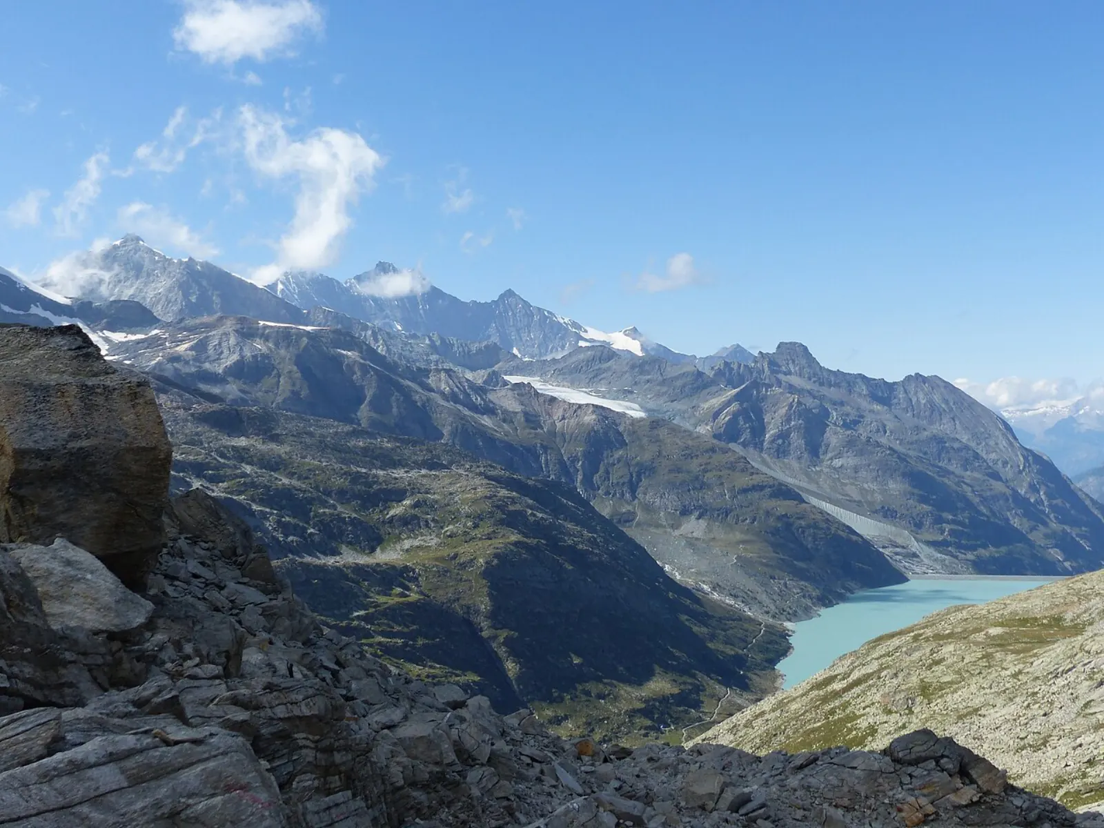
Mattmark reservoir from Saas-Almagell
Mattmark is the large earth dam and reservoir at the head of the Saas Valley above Saas-Almagell. Reach it seasonally by PostBus or by car, decide whether you want a short dam stop or a full lakeside walk, and confirm bus dates, parking and facilities before you go.
Mattmarksee with Lenzspitze, Dom and the Allalin glacier beyond.
Some hotel links are affiliate links. We may earn a commission at no extra cost to you. Read the disclosure.
Mattmark is the defining up-valley outing from Saas-Almagell: a major earth dam, a high reservoir (around 2,200 m in tourism context), visitor facilities when open, and walking options around the shore. Saastal Tourism’s Mattmark dam in summer page is the primary operational reference for buses, parking tariffs, restaurant hours and on-site amenities — always re-open it for your travel year.
This page owns visiting the place. Turn-by-turn lake navigation can deepen on a dedicated lake-walk article when published; until then, pair this guide with Valais Tourism’s Mattmark reservoir hike description for route evidence.
Before you set off (non-negotiable checks)
- Read official opening information for Saas-Almagell alongside the dam summer page.
- Confirm outbound and return transport — especially last PostBus times from the linked timetable.
- Choose visit type using the table below — a dam photo stop and an 8 km circuit are different trips.
- Pack layers, sun protection and wind layer; altitude is significantly higher than the village at 1,672 m.
This site does not assert that the road, bus, restaurant or path is open on the day you read this article.
Choose the kind of visit (decision table)
| Visit type | Plan for | Do not assume |
|---|---|---|
| Dam / viewpoint stop | Current access, parking or bus, short walk on crest | Restaurant staffed every historical hour |
| Partial shore walk | Turnaround time, weather, children’s stamina | Full circuit completed casually before last bus |
| Full lakeside circuit | ~8 km / ~2h15 per Valais Tourism; modest height gain | Every section matches west-shore accessibility notes |
| Longer hikes (Monte Moro direction) | Separate route research, fitness, pass/border context | Dam visit equals an international pass crossing |
Getting there from Saas-Almagell
PostBus (usual public pattern)
Saastal Tourism states you can reach the reservoir by PostBus from Saas-Almagell and notes PostBus trips can be included from the first night with the SaastalCard during a partner stay (arrival/departure exclusions still apply — SaastalCard).
For 2026, the dam summer page states PostBus runs to Mattmark from 13 June to 25 October. Open the linked timetable for exact departures and last return — missing the last bus is the most common Mattmark mistake.
Build the dated journey in SBB even if you hold a guest card; verify the card’s validity on PostBus for your ticket type when boarding.
Car
The official dam summer page lists parking at Mattmark with published tariffs (checked 2026-10-20): CHF 1 / 1h, CHF 2 / 2h, CHF 3 / 3h, CHF 4 / 4h, and CHF 5 from 4 hours up to 24 hours. Confirm on the day; tariffs change.
Driving does not remove the need for a return plan — road status, weather and congestion still matter. Winter and shoulder-season access may differ from summer marketing windows.
Facilities (confirm before relying on them)
Official Mattmark summer material references:
- Views of the reservoir and Monte Moro Pass area
- Reservoir tour options for pedestrians and bikers when offered
- Exhibition / visitor information linked to the dam and hydropower context
- Restaurant Mattmark with published seasonal opening hours for 2026 (early season shorter hours; from mid-June longer evening hours on Fri–Sat on the official page)
- Newer amenities such as e-bike charging and a camper area — verify current rules on the official page
Treat restaurant hours as seasonal schedules, not guarantees for your exact Tuesday in October.
Walking the reservoir (planning from Valais Tourism)
Valais Tourism describes a circuit of about 8 km and roughly 2 hours 15 minutes with modest ascent — planning estimates, not promises for your pace or weather.
Accessibility language on the west shore for wheelchairs and strollers applies to that described segment, not an automatic green light for every tunnel, shore section or buggy wheel type. Assess on site or choose a partial out-and-back if unsure.
Carry a current map, check MeteoSwiss Saas-Almagell for afternoon storm risk in summer, and avoid committing to the full loop if return transport is fixed.
SaastalCard, tickets and valley context
Mattmark is a same-valley excursion from Saas-Almagell, not an intercity trip — local mobility framing lives on Getting around. Partner guests may find in-valley PostBus to Mattmark in scope during the stay under published summer/autumn SaastalCard wording, but arrival and departure valley buses remain excluded.
If you are not in a partner property, budget ordinary PostBus fares. Parking is separate from the card’s Saas-Fee parking reduction notes on the official card page.
History note (context, not itinerary)
On 30 August 1965, ice and debris from the Allalin glacier struck the dam construction site; 88 people died. Official tourism pages acknowledge this disaster. Visitors should treat memorial and safety context respectfully and follow all site signage and staff instructions.
Sample day outlines (assumptions stated)
Half-day bus visitor (summer). Morning PostBus from Saas-Almagell; dam crest viewpoints; coffee or lunch if Restaurant Mattmark is open; return on a bus you verified before leaving the village. Buffer 30 minutes for weather or photo stops.
Full circuit day. Start early; complete the Valais-described loop only if return transport and weather allow; carry food backup if restaurant hours are uncertain.
Driver with mixed group. Park per published tariffs; agree meet times; consider splitting — short viewpoint for some, partial walk for others — rather than forcing one pace.
Packing and altitude (2,200 m planning)
| Item | Why it matters at Mattmark |
|---|---|
| Wind layer | Open dam crest exposure |
| Sun cream | UV increases with altitude |
| Water + snack | Restaurant hours are seasonal, not guaranteed |
| Map or offline route | Mobile signal not assumed on full circuit |
| Time buffer | Last PostBus missed = stressful evening |
Children tire faster at altitude — partial walks beat forced full loops.
Photography and viewpoint ethics
The dam crest and shore paths are popular photo stops. Official tourism encourages visitor access when open, but construction, maintenance or safety closures override social media expectations. Drone rules change — follow on-site signage rather than assuming alpine “open air” means unrestricted flying.
Memorial context from the 1965 disaster means some areas deserve quiet behaviour even when crowds are light.
Winter and shoulder access (separate from summer bus season)
Summer PostBus windows (example 13 June–25 October 2026) do not describe January access. Winter visitors from Saas-Almagell should read official Saastal pages and Best time to visit before treating Mattmark as a snow-season highlight. Road status, services and pedestrian access may differ entirely from the dam summer marketing page.
If Mattmark is closed, redirect to Furggstalden winter products on Winter rather than improvising summer shore tracks on snow.
Combining Mattmark with other same-day plans
| Combination | Realistic? | Notes |
|---|---|---|
| Mattmark AM + Furggstalden PM (summer) | Sometimes | Watch last Mattmark return and lift hours |
| Mattmark full circuit + Adventure Trail | Rarely | Both are full days alone |
| Mattmark + Saas-Fee stroll | Only with early start | Bus time eats margin |
| Mattmark + grocery run | Easy if passing Grund/Fee on return | Still mind last bus |
Default to one headline outing per day unless your group is fit and transport margins are wide.
Common Mattmark mistakes
- Arriving without checking last bus back to the village.
- Treating Valais west-shore accessibility as “entire loop stroller-friendly.”
- Assuming the restaurant is open because “it’s summer.”
- Confusing Mattmark road access with year-round village driving conditions.
- Planning Monte Moro pass hikes from a casual dam stop without separate route research.
- Ignoring altitude — sun and wind at ~2,200 m hit harder than in the village.
- Using undated third-party GPS tracks instead of official route pages.
Related planning
- Getting around — valley buses and card limits
- Summer — season dependencies for lifts and village days
- Where to stay — overnight base in Saas-Almagell
- Things to do — where Mattmark fits a wider list
- Travel guide — full planning sequence
No unverified third-party tour is promoted here as a “Mattmark tour from Saas-Almagell.” Plan with official Saastal and Valais sources and your dated transport search.
Hydropower and visitor information (why the dam matters)
Saastal Tourism links Mattmark summer visits to reservoir tours, exhibition material and the scale of the earth dam — Europe’s largest earth dam appears repeatedly in official copy as context, not as a daredevil photo challenge. Visitor information and tour availability depend on season and staffing; the dam summer page is the place to see what is offered for pedestrians and bikers in your year.
Understanding that Mattmark is a working landscape (power, water, safety rules) sets expectations better than treating the lake purely as a beach substitute.
E-bikes, camper area and newer amenities
Official Mattmark summer material references amenities such as e-bike charging and a camper area with rules that change. Verify on the official page before routing a motorhome or planning a long e-bike loop that assumes charging at the dam. Camper guests elsewhere in the valley sometimes receive SaastalCard through special Saas-Fee office rules — that exception does not generalise to every parking area at Mattmark.
Monte Moro direction hikes (explicitly separate)
Tourism mentions Monte Moro Pass and border-country hiking from the broader Saastal. A dam parking stop does not mean you are prepared for a pass crossing: fitness, time, border documentation and route research are separate projects. Valais Tourism and Saastal route pages must be read in full before you leave the reservoir carpark on an ambitious line.
If your group only has half a day, keep to the reservoir circuit or crest viewpoints described on Valais Tourism’s Mattmark hike page.
Accessibility planning (west shore vs full loop)
Valais Tourism’s west-shore language for wheelchairs and strollers is valuable but narrow. Tunnels, shore irregularities and group pace can still turn a “accessible loop” into a long day. Scout turnaround points on a map before you commit the whole family to a full circuit, and carry a backup plan if surfaces are icy or muddy in shoulder weeks.
Saastal accessible travel pages are a starting point for broader needs — confirm each segment on the ground.
Post-trip debrief questions (for your notes)
After you visit, note for future travellers: actual bus punctuality on your date, restaurant open/closed despite website hours, wind on the crest, and whether the west-shore accessibility note matched your stroller. This site updates from sourced evidence — your private debrief helps you rebook smarter, not replace official timetables.
Quick reference card (copy to trip notes)
| Item | Official check |
|---|---|
| Bus season | Mattmark dam summer page |
| Live status | Open facilities Saas-Almagell |
| Circuit stats | Valais Tourism Mattmark hike |
| Valley mobility | Getting around |
| Guest card limits | SaastalCard |
Reconfirm each row for your travel year before you paste into a shared group chat — teammates should not treat a static screenshot as law.
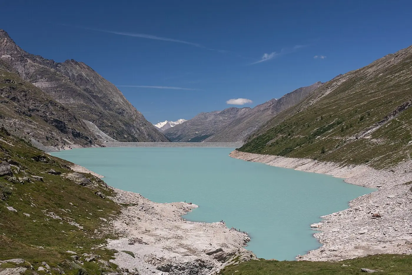
Bookable ideas
Tours & activities in the region
Some hotel links are affiliate links. We may earn a commission at no extra cost to you. Read the disclosure.
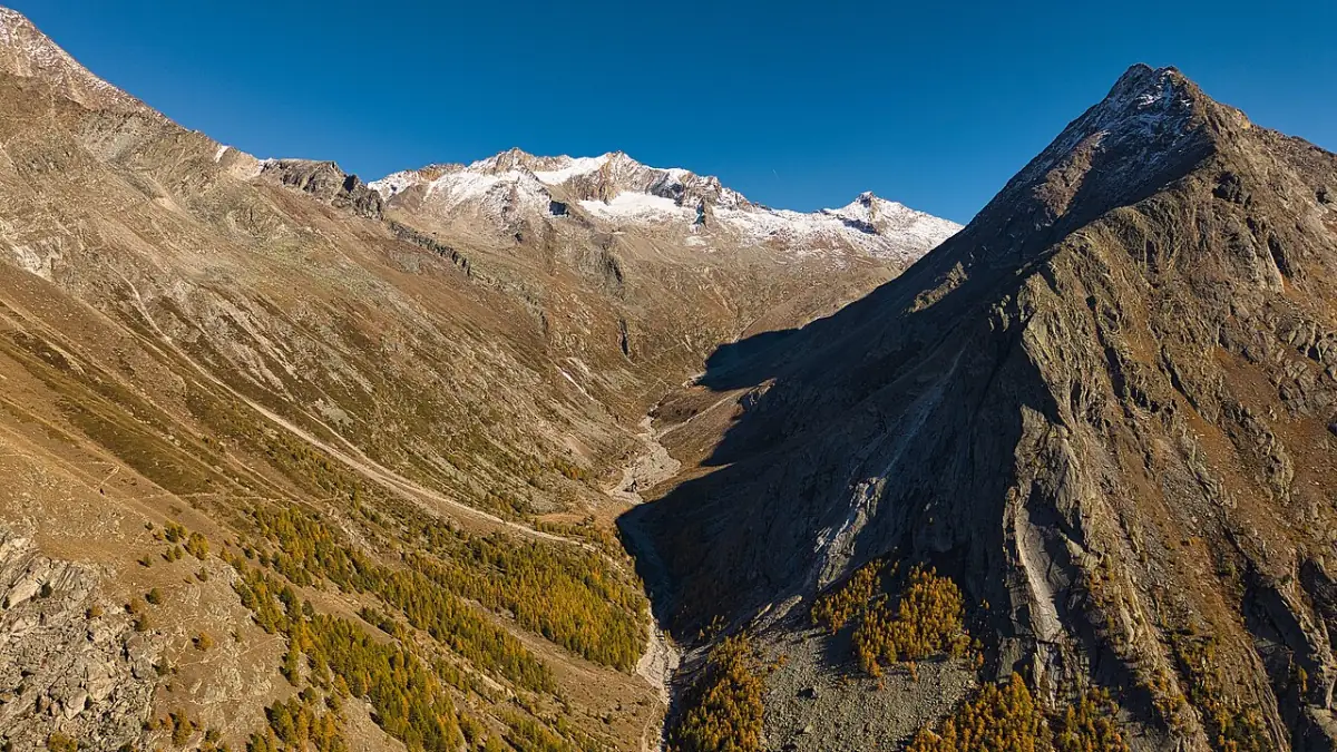 Hiking
Alpine hiking around Saas-Almagell
Valley walks, reservoir loops and higher options — timing depends on lift and bus operations.
- Confirm departure town and season on the partner page
- Recheck weather and lift status on the day
- Not a substitute for local mountain advice
- Viewpoints
Glacier and high-mountain viewpoints
High viewpoints often route via Saas-Fee — clarify meeting point before you pay.
- Meeting point is not always your hotel village
- Check fitness and family fit on the listing
- Read cancellation terms with the provider
- Day trip
Mattmark and valley day outings
Reservoir days and village hops — some transfer products start far from Almagell.
- Confirm seasonal bus and road access
- Verify departure town in the ticket text
- Independent PostBus options remain available
 Winter
 days in the Saas Valley
Ski and winter products often list Saas-Fee — confirm pass, meeting point and kit before payment.
- Not a live piste or avalanche bulletin
- Budget transfer time to the meeting point
- Use only attributed partner links from this site
See all regional tours & tickets →
Browse live listings
Loading live listings…
Planning questions
Is the full lake circuit suitable for a stroller?
Valais Tourism describes the west shore as wheelchair- and stroller-accessible on the lakeside circuit. That does not automatically make the entire loop suitable for every buggy — assess surfaces, tunnels and your group before committing.
When does the PostBus run to Mattmark?
Seasonally. Saastal Tourism published PostBus service to Mattmark from 13 June to 25 October 2026 on the dam summer page. Confirm the current year’s timetable before travel.
How long is the walk around the reservoir?
Valais Tourism lists about 8 km and roughly 2 hours 15 minutes for the circuit, with modest ascent. Treat figures as planning estimates and carry a current map.
Can I visit Mattmark in winter?
Access and services differ by season. Check official Saastal pages and road/bus status for your dates rather than assuming summer bus schedules apply.